
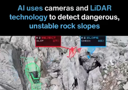

Natural geological hazards pose severe threats to critical infrastructure, mountain highways, railway lines, and industrial mining sites worldwide.
Traditional slope monitoring methods often fail to detect subtle microscopic ground movements before catastrophic structural failures occur.
The integration of artificial intelligence into geotechnical monitoring is transforming how engineers predict and prevent dangerous rockslides.
Combining High-Resolution Cameras and Advanced LiDAR Sensors
Modern early-warning systems leverage a powerful combination of high-resolution digital cameras and active laser-based LiDAR scanning sensors.
LiDAR technology emits millions of laser pulses to measure exact surface distances, constructing millimeter-precise digital representations of cliffs.
Simultaneously, high-resolution optical cameras capture detailed visual textures across vast, rugged mountain terrain and steep rock faces.
Building Detailed Three-Dimensional Models of Rocky Terrain
Merging camera data and LiDAR point clouds enables systems to generate highly detailed three-dimensional models of rocky environments.
These comprehensive 3D models map every surface contour, structural fissure, and geological irregularity across vulnerable mountain corridors.
Civil engineers can inspect previously inaccessible cliff faces remotely without exposing inspection crews to active rockfall hazards.
Detecting Cracks, Loose Rocks, and Unstable Slopes
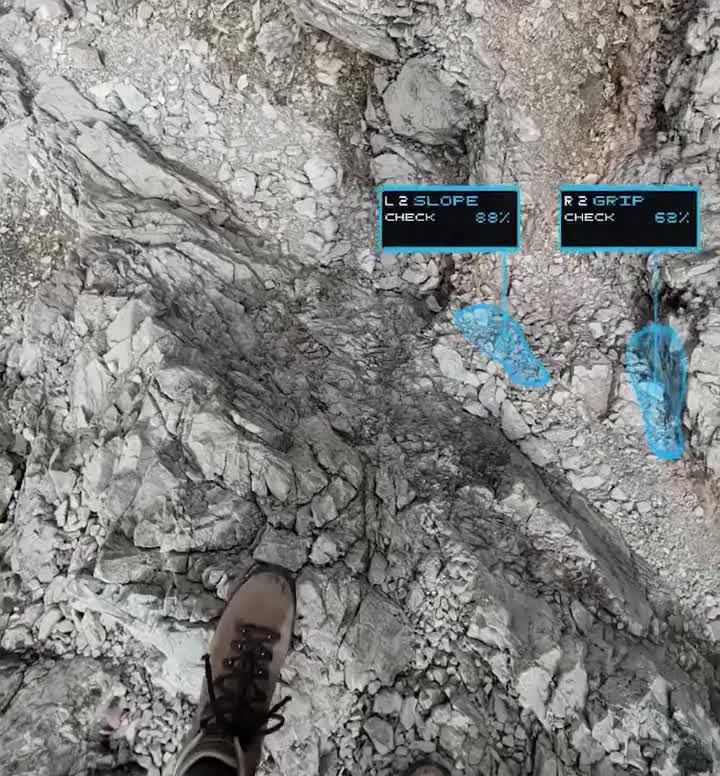
Artificial intelligence algorithms analyze complex 3D surface models to identify micro-fractures, loose debris, and shifting rock formations instantly.
Machine learning models recognize structural patterns that typically precede slope failures, flagging high-risk zones automatically for engineers.
Early identification allows maintenance teams to secure unstable zones before minor geological shifts escalate into major disasters.
Tracking Temporal Changes Through Continuous Multi-Scan Analysis
Geological instability rarely happens overnight, making continuous historical scan comparisons essential for accurate long-term slope forecasting.
By comparing sequential 3D scans captured over weeks or months, systems track subtle surface displacement with extreme precision.
Detecting millimeter-level movement over time provides vital early warnings long before visible surface cracking appears to human observers.
Securing Mountain Highways, Railways, and Infrastructure
Tragic rockslides frequently disrupt vital transportation corridors, endangering motorists and stalling freight transport across mountainous regions globally.
Deploying intelligent automated monitoring networks along mountain highways and railway tracks safeguards daily commuter travel effectively.
Proactive intervention prevents costly infrastructure damage, trade bottlenecks, and tragic loss of life along dangerous transit routes.
Revolutionizing Safety Protocols in Global Mining Sites
Open-pit mining operations face constant geotechnical risks as heavy excavation alters surrounding cliff stability and earth structures.
Integrating artificial intelligence and LiDAR monitoring protects heavy equipment operators and miners working near unstable excavation walls.
Automated hazard detection systems trigger immediate evacuation alarms the moment abnormal slope acceleration or ground displacement is detected.
Overcoming Challenges in Remote Terrain Data Collection
Monitoring remote, weather-beaten mountain ranges presents significant logistical hurdles for civil engineering teams and infrastructure managers.
Modern LiDAR and camera setups operate autonomously using solar power and wireless communication links in isolated locations.
Autonomous data collection ensures continuous surveillance even during severe weather conditions when manual inspections are impossible.
The Future of Smart Infrastructure and Geotechnical AI
As computer vision and spatial artificial intelligence models advance, predictive geotechnical monitoring will become an industry standard.
Future infrastructure networks will feature self-monitoring slopes equipped with real-time hazard mitigation actuators and automated warning systems.
Combining advanced sensors with intelligent automation ensures a safer, more resilient built environment for generations to come.
Stay Informed with AI Curate Hub
Navigating fast-moving artificial intelligence applications, engineering innovations, and safety technology trends is essential for modern professionals.
Following trustworthy digital news platforms helps engineers understand how automated monitoring systems reshape global infrastructure standards daily.
Follow @AICurateHub across social media platforms for timely news alerts, technical analyses, and concise digital media summaries.
Visit aicuratehub.com today to explore in-depth articles covering geotechnical artificial intelligence, engineering safety tools, and emerging tech trends.